U.S. Army Corps of Engineers Announces Intent to Close Oceti Sakowin #NoDAPL Camp
UPDATE: Sunday, November 27, 2016 – The U.S. Army Corps of Engineers issued a public statement reaffirming they plan to officially close the land which includes the Oceti Sakowin camp. However, the Corps also states that it “has no plans for forcible removal” of the thousands of water protectors who have been camped out for months and are erecting winterized structures.
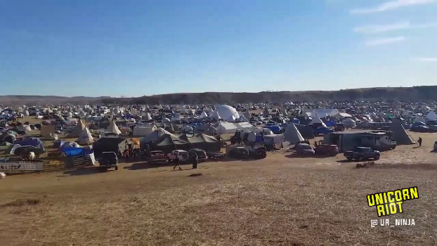
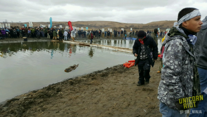
Oceti Sakowin, ND – The Army Corps of Engineers sent a letter, dated November 25th, to Standing Rock Sioux Tribal Chairman Dave Archambault II stating the Army’s intention of “closing the portion of the Corps-managed federal property north of the Cannonball River to all public use and access effective December 5, 2016.” The Oceti Sakowin encampment, previously referred to as the #NoDAPL overflow camp, is currently located on the property that the Army references and can be seen in the video below from November 25th.
A view of #NoDapl resistance camps. pic.twitter.com/qGEMaUC9S5
— Unicorn Riot (@UR_Ninja) November 25, 2016
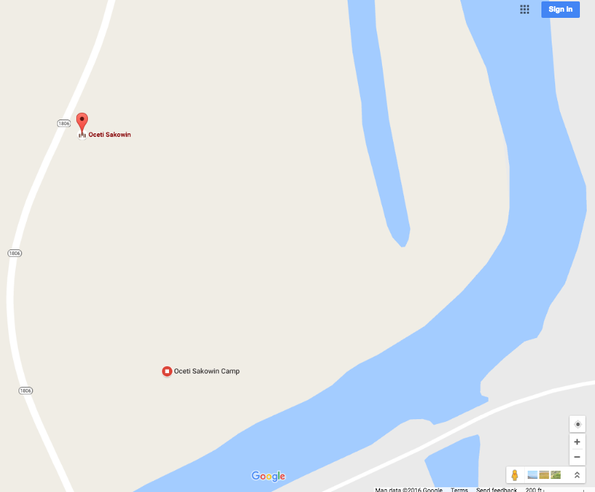
The location of the camp can also be seen on Google Maps:
Colonel John W. Henderson, the Corps of Engineers Omaha District Commander, stated in the letter sent to the Tribal Chairman that pursuant to 36 C.F.R. § 327.12, “no member of the general public, to include Dakota Access pipeline protestors, can be on these Corps’ lands.” This statement effectively negates the special use permit issued on September 16th, which allows Standing Rock Sioux Tribe to engage in a lawful free speech demonstration on those lands.
Col. Henderson is invoking the Code of Federal Regulations (C.F.R.) Title 36 – Parks, Forests, and Public Property. Part 327 is “the rules and regulations governing public use of water resource development projects administered by the Chief of Engineers“. The .12 section refers to 327.12, which is “restrictions“.
36 C.F.R. § 327.12 Restrictions state:
“The District Commander may close or restrict the use of a project or portion of a project when necessitated by reason of public health, public safety, maintenance, resource protection or other reasons in the public interest. Entering or using a project in a manner which is contrary to the schedule of visiting hours, closures or restrictions is prohibited.” – 36 C.F.R. § 327.12
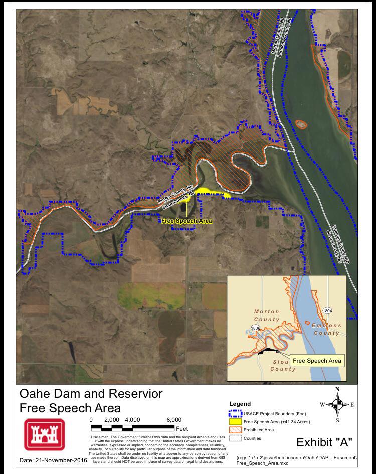
In the first sentence of the second paragraph, the Army states that they have “established a free speech zone on land south of the Cannonball River for anyone wishing to peaceably protest the Dakota Access pipeline project, subject to the rules of 36 C.F.R. Part 327.” Within the rules such as no smoking and quiet times of 10 p.m. to 6 a.m.
The letter states that “any person found to be on the Corps’ lands north of the Cannonball River after December 5, 2016, will be considered trespassing and may be subject to prosecution under federal, state, and local laws.”
A map of the Army Corps boundary and the newly created “Free Speech Area” is pictured below.
In the next sentence, the terms “unlawful” and “occupation” are in dispute, as the land in question is unceded Sioux nation land under the 1851 treaty of Fort Laramie.
“Furthermore, any person who chooses to stay on these Corps’ lands north of the Cannonball River does so at their own risk, and assumes any and all corresponding liabilities for their unlawful presence and occupation of such lands.” – Colonel John Henderson
The Army stated that “many Title 36 violations” are occurring at the Oceti Sakowin camp, such as, “unauthorized structures, fires, improper disposal of waste, and camping.” They then speak directly to the tribal government about this “illegal activity“, stating:
“Additionally, any tribal government that sponsors such illegal activity is assuming the risk for those persons who remain on these lands.” – Colonel John Henderson
In the last paragraph of the letter, Colonel Henderson says:
“As I have publically [sic] stated, I am asking you, as a Tribal leader, to encourage members of your Tribe, as well as any non-members who support you who are located in the encampments north of the Cannonball River on Corps’ lands to immediately and peacefully move to the free speech zone south of the Cannonball River or to a more sustainable location for the winter. I am genuinely concerned for the safety and well-being of both the members of your Tribe and the general public located at these encampments.” – Colonel John Henderson
Read the full letter below:
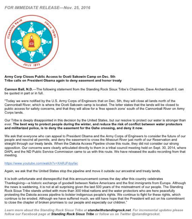
chairman_archambault-11-25-16The Standing Rock Sioux Tribe issued a press release responding to the Army Corps of Engineers announcement of their intention to close the camp:
Aside from disputes regarding broken treaties by the U.S. Government, there are also decade-old disputes around the Army Corps of Engineers and the Missouri River. The Pick-Sloan Act of 1944 “authorized the Army Corps of Engineers to construct and operate five massive earthen dams on the main stem of the Missouri River for flood control, navigation and hydropower.” Subsequently, the Army Corps of Engineers flooded the lands of the Plains Indians Tribes, as “federal legislation authorizing the acquisition of tribal lands for the site of the reservoirs” was enacted.
Samantha L. Varsalona, wrote in a piece titled ‘Pipelines, Protests and General Permits‘ that “the Oahe Dam not only destroyed a site of spiritual significance to the Sioux, but also flooded nearly fifty-six thousand acres of Standing Rock Reservation and over one hundred four thousand acres on the Cheyenne River Reservation.” In the November 7th post that is part of the Environmental Law Review Syndicate, statements are made regarding the historical controversy and significance of the damming projects by the Corps:
“Overall, the construction of the Oahe Dam destroyed more Indian land than any other public works project in America.” – Samantha L. Varsalona, Staff Member, Georgetown Environmental Law Review
The cultural and spiritual significance of the damming of the Missouri River is also addressed by Jon Eagle Sr., the Tribal Historic Preservation Officer of the Standing Rock Sioux Tribe, in the article ‘When Man Changes the Land, It Is Changed Forever‘:
“Long ago our ancestors knew the Cannon Ball River as Inyan Wakan Kagapi Wakpa, “River where the sacred stones are made,” and they knew the Missouri River as Mni Sose, “Turbulant Water.” At the confluence of where those two rivers met was a great whirlpool that created perfectly round stones that were considered to be sacred. When the U.S. Army Corps of Engineers dredged the Cannon Ball River and altered its course, the rivers quit making those stones. That federal undertaking had an adverse effect on an area of religious and cultural significance to our people. We will never again see this. When man changes the land it is changed forever.” – Jon Eagle Sr., Tribal Historic Preservation Officer of the Standing Rock Sioux Tribe
Since the Army Corps does not have its own law enforcement personnel, it is unclear who would potentially enforce trespassing charges. Any operation to disband the Oceti Sakowin encampment could possibly be carried out by Bureau of Indian Affairs federal police who are active in the area, the North Dakota National Guard, or possibly the Morton County Sheriff and assisting agencies who have thus far been permitted to come onto some Army Corps lands to carry out field force operations against water protectors.
Unicorn Riot is committed to continuing to provide direct updates from North Dakota. We will be on the ground on December 5th to cover events as they unfold.
To help our volunteer-operated, horizontally-organized, non-profit media collective please consider a tax-deductible donation:
Below is Unicorn Riot’s coverage of the [#NoDAPL] anti-Dakota Access Pipeline struggle from early summer 2016 to present:
March – May 2016
- March 29th, “Tribal Citizens Prepare to Blockade Bakken Oil Pipeline“.
- April 3rd, “Tribal Citizens Build Camp in Path of Oil Pipeline“.
- May 5th, “Sacred Stone Camp Resists Dakota Access Pipeline“.
- May 27th, “Dakota Access Pipeline Blockade Enters 2nd Month“.
August 2016
- After covering the camp in the spring of 2016, Unicorn Riot returned to Standing Rock Reservation on Wednesday, August 10th, when Standing Rock tribal members and allies blocked the entrance to the Dakota Access Pipeline construction site.
- On Thursday, August 11th, a dozen or so people were arrested blocking the construction site entrances.
- Day 3, Friday, the fight to protect land & water intensified around the construction sites of the Dakota Access Pipeline.
- On the 4th day, the pipeline resistance encampment swelled and prepared for more action.
- Monday, August 15th, land defenders stormed the construction site halting construction, and the next day construction was halted as well.
- August 17th saw State Police begin checkpoints, roadblocks, and psyops as protesters united to defend water.
- August 24th, camps prepared as Federal injunction hearing looms.
- Camps Organize to Stay as Injunction Postponed.
- On August 31st, Non-Violent Direct Action Stopped DAPL Construction for Over 6 Hours.
September 2016
- September 6, indigenous water protectors swarmed Dakota Access Pipeline site, stopped work
- September 7, Uŋpa Nuŋpa was interviewed about ongoing #noDAPL actions
- North Dakota highway patrol refused to release email correspondence with Energy Transfer Partners
- September 8, ND National Guard took over Dakota Access Pipeline checkpoints
- Friday, September 9, US Govt. overruled federal judge and requested pipeline construction halted at Lake Oahe
- Meanwhile, cultural activities continued at #NoDAPL camps despite more arrests/warrants
- September 13, 20 were arrested during #NoDAPL lockdown, including 2 Unicorn Riot journalists
- September 14, direct actions continued against Dakota Access Pipeline while legal repression intensified
- On September 16 a federal judge dissolved the unconstitutional temporary restraining order Dakota Access, LLC had filed against Stranding Rock tribal members
- September 19, as solidarity protests spread nationwide, the federal appeals court ordered construction temporarily stop on Dakota Access segment as Solidarity Protests Spread Nationwide
- September 21, #NoDAPL noise demo demanded freedom for jailed water protector Olowan Martinez
- September 22, water protectors disrupted the annual meeting of the North Dakota Petroleum Council
- September 25, water protectors planted trees on DAPL construction site
- In Iowa on September 26, a non-violent direct action from the Mississippi Stand camp stopped DAPL construction for the day
- September 26, a caravan of water protectors stopped work at DAPL site
- September 27, militarized police arrested 23 water protectors in DAPL work stoppage
- September 29, a #NoDAPL solidarity action took place at MN Enbridge office
October 2016
- October 3rd-4th saw the “Toxic Tour,” Governor debate disruption, and water protectors attend their court arraignment
- October 4, we learned North Dakota Governor Dalrymple’s email inbox was full of support for #NoDAPL
- October 5, Buffer Zone Holds as Caravans Continue to Disrupt DAPL – New Felony Charges
- October 7, 6 Arrested in Iowa #NoDAPL Action, Including Unicorn Riot Journalist
- October 8, Iowa Water Protectors Blockade DAPL Drill Site Twice in 24 Hours
- October 9, Federal Appeals Court Rules to Allow DAPL Construction
- October 10, 27 Arrests After Water Protectors Pray at DAPL Site on Indigenous People’s Day
- October 12, Lockdown Stops DAPL Construction in Iowa, 3 Arrested, Including Unicorn Riot Journalist
- October 14, Emails Show North Dakota Budget Bureaucracy Behind #NoDAPL Policing
- October 16, Direct Actions Continue to Stop DAPL Construction in Iowa and North Dakota
- October 17, Four Unicorn Riot Journalists Face Charges For Covering #NoDAPL
- October 17, Water Protectors Blockade Highway in Bismarck, Some Charges Dropped
- October 20, As DAPL Construction Advances, Water Protectors Continue Direct Action
- October 22, Water Protectors’ Prayer Walk Ends up with 127 Arrests, Including Unicorn Riot Journalist
- October 23, Law Enforcement Attack Private Drone as Water Protectors Erect Blockade & New Winter Camp
- October 24, Mississippi Stand Blockades Iowa DAPL Drill Waste Site, Drilling Stops
- October 25, Records Release: Morton County’s Law Enforcement Mutual Aid Assistance Agreement
- Hundreds Flood Minneapolis City Hall to Demand Local Sheriff Withdraw from North Dakota
- October 26, Tensions Rise as Pipeline Construction Nears #NoDAPL Blockade
- October 27, Police and Military Attack Oceti Sakowin Treaty Camp
November 2016
- November 1, #NoDAPL Solidarity Rally & Sit-In in Minneapolis Prods Sheriff into Removing Deputies
- November 1, DAPL Resistance Continues Despite Advancing Construction
- November 2, Police Attack Water Protectors Defending Sacred Sites
- November 5, DAPL Construction Nears US Army Corps Land While Still Lacking Permits
- November 6, Water Protectors Attempt to Reclaim Sacred Burial Site, Demonstrate in Cemetery
- November 8, Dakota Access Announces Plan to Drill Under Missouri River Within Weeks
- November 11, Dakota Access Pipeline Work Stopped As Water Protectors Storm Site; 30+ Arrested
- November 14, #NoDAPL Water Protectors March on ND State Capitol after Caravan Disrupts Construction
- November 14, Mississippi Stand Goes Inside Pipeline and Shuts Down DAPL Construction
- November 14, Army Corps Delays DAPL Easement
- November 15, “No More Stolen Sisters” Demonstration Blockades DAPL Man Camp; 25+ Arrests
- November 16, Despite Army Corps Statement, DAPL Moves Horizontal Drill to Missouri River Crossing
- November 17, Demonstration in Bismarck-Mandan, Cass County Deputies Beat Man Bloody
- November 20, Police Attack Unarmed Water Protectors w/ Rubber Bullets, Tear Gas, and Water Cannons; 300+ injured
- November 21, Land Defense & Water Protection Actions Ripple Across Turtle Island
- November 22, Hundreds Target U.S. Army Corps Building in St. Paul w #NoDAPL Message
- November 22, Anonymous DDOS Munitions Vendor After Sheriffs Attack #NoDAPL
- November 22, #NoDAPL Water Protector Faces Possible Loss Of Her Arm After Police Attack
- November 24, Water Protectors Bridge onto Turtle Island; Mandan Thanksgiving Street Feast
